Networking Workshop on Decision Framing and Uncertainty
27. February 2018
SzenarienDB project kick-off
2. March 2018Prioritization of locations for off-grid rural electrification in Tanzania

The project aimed at prioritizing locations in Tanzania with regard to their attractiveness for off-grid electrification, specifically mini-grids.
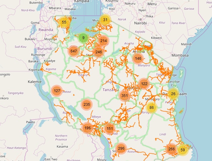
Tanzania’s national electrification is only approximately 30 percent, with considerable gaps in energy supply in rural areas. To better understand which locations would benefit from decentralized approaches, detailed spatial data was collected on settlement locations and settlement structures. This data was further combined with as much site-information as possible, focusing on productive use, socio-economic activities, or availability of renewable energy resources.
The compiled information was used to identify and rank locations which fulfil required criteria for off-grid solutions. This includes a minimum distance to the existing transmission infrastructure or a minimum number of potential users in one location. The prioritized settlement sites were visualized in a web map and will form the base data for further analysis on a household level.
Project duration: November 2017 – February 2018
© Image: Michelle Maria, Scenes around Karatu, Tanzania - panoramio (37), cropped and words added by RLI, CC BY 3.0
RLI assumes the following tasks in this project:
- Lead the remote geodata collection and analysis
- Contribute to an interactive workshop with stakeholders from the Government of Tanzania as well as the private sector to understand local data and information needs
- Conduct the prioritization of sites in an reproducible way and visualize results in a web map
- Publish and document all openly available data sets


